Geoscientific information
Department of Geology and Mines
Landslide Inventory Map of Bhutan Category: Open
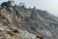
This inventory contains field-verified landslide point data collected between 2020 and 2025 from 15 Dzongkhags across Bhutan. The database was developed through remote sensing interpretation and field verification, with surveys focusing on landslides that pose risks to settlements, transportation networks, and critical infrastructure. The inventory shows a higher concentration of landslides in southern Bhutan, particularly in Samtse and Samdrup Jongkhar, while fewer landslides were recorded in Trashiyangtse and Lhuentse. The greater occurrence of landslides in the south is associated with fragile geology, major fault and thrust systems, and intense monsoonal rainfall. In contrast, many landslides in the northern and central regions are linked to road construction and other infrastructure development activities. The inventory provides a baseline dataset for landslide hazard assessment, susceptibility mapping, risk analysis, and disaster risk reduction planning in Bhutan. Limitations: The inventory primarily includes landslides with observable impacts on settlements and infrastructure. Due to accessibility and logistical constraints, some remote areas were not comprehensively surveyed. Future updates will incorporate these areas to improve the completeness of the database and strengthen landslide hazard assessments across Bhutan.
Keywords: []